
Resources for Geography Teachers
|
A collection of resources for teachers who are teaching Human Geography (Including Advanced Placement), Geographic Information Systems (GIS), International Studies, and World Geography. Located below there is a collection of resources that can be used in any one of those courses. The course specific resources can be viewed by scrolling down and selecting the appropriate link, or choosing them from the drop down menu above. Located in order below you can find the following items:
- Course Specific Resources - General Geography Resources - Geography Standards - Learning Environments - Content Specific Resources Links - Games and Activities - Videos and Series | ||
Course Specific Resources
|
|
|
|
General Geography Resources
American Association of GeographersA more wide ranging professional organization, the American Association of Geographers works to advance the field of geography by connecting people working in geography at all levels.
ESRI
Quickly becoming the leader in GIS technology for education. ESRI provides training for anyone interested, example lessons incorporation GIS, and a free GIS site licence for educational institutions.
Google Earth
Google's downloadable interactive mapping program allows users to explore the globe using google maps and google imaging
National Council for Geographic Education (NCGE)Chartered in 1915 the NCGE works to increase the status and quality of geographic education in the United States. They offer resources, professional development, and access to academic materials
National Geograpic Education
Collection of educational resources put together by National Geographic for teachers. Educators can find lesson ideas, reference and mapping materials, and information about National Geographic Programs. Also check out information on the National Geographic Certified Educator program.
|
ArcGIS Earth
Produced by ESRI this downloadable software allows users to view different locations in 2D and 3D formats. Compatible with KML data files
Geocapabilities
The Geocapabilities initiative is a joint venture between researchers and educators in the United States, European Union, and the United Kingdom that further investigates "powerful geography" and the training of effective educators.

The MAGE website is helpful collection of Resources, Curriculum, and ideas for teaching geography. One of the particularly helpful resources are the podcasts in the curriculum section dealing with different geographic topics.
National Council for the Social Studies
Established in 1921 the NCSS unites teachers from all the fields of Social Studies with the goal of advancing Social Studies education. NCSS provides teachers with a number of professional development opportunities, resources, standards, and ways that you can help.
Network of Alliances for Geographic Education
Preserved by the hard work and dedication of each members, the state geography alliance network lives on! Each state works with local teachers to provide professional development, networking, and lesson ideas.
Put together by the. Grosvenor Center for Geographic Education and the National Center for Research in Geography Education at Texas State University, the powerful geography movement is the cutting edge of pedagogy for the modern teaching of geography.
|
Canadian Geographic Education
Resources, teaching strategies, and connections provided by Canadian Geographic. This newly redesigned website provides helpful ways for teachers to more effectively deliver geographic content.
Geographic Educators of Nebraska
National Geographic
The primary source for geographic information since the 1880s. The National Geographic Society has made its reputation as one of the most reputable sources of photographs, articles, and maps from around the world.
Open Geography Education
A collection of resources and materials made freely available by R. Adam Dastrup from Salt Lake Community College. Resources include free creative commons textbooks and resource lists.

|
Geography Standards

|

|
National Standards for Geographic EducationNational Geography Standards IndexGeographic SkillsGeography Education National Implementation Project |
Common Core English and Language Arts StandardsStandards in your State (Interactive Map)English Language Arts Standards: History/Social Studies |
|
Learning Environments
EarthXplorers
This learning environment blends learning the skills of GIS together with issues facing historical sites. A partnership between ESRI, the National Trust for Historic Preservation, and the University of Minnesota's LT Media Lab. This unique environment has students look at an issue related to a historic site, and then look at a similar issue locally.
|
WeExplore
Adventure Learning based environment that allows students to view and create expeditions which allows student to engage in inquiry based learning. Encourages students to explore contemporary issues with the aid of technology.
|
|
AP Human Geography
Global Studies
|
Biogeography
Human Geography
|
Cartography
Physical Geography
|
Ecogeography
World Environmentalism
|
Geographic Information Systems
World Geography
|
Games and Activities
Geoguessr
Game based off the google street view where players are given a random street view and then have to guess where it is based on visible physical and human characteristics.
The Redistricting Game
This interactive game is particularly helpful for teaching the Political Geography concept of Gerrymandering. Students examine how different factors can lead to the changing of voting congressional districts in favor of one party over another.
|
GEOCACHING
Combine the use of GPS with the challenge of a high tech scavenger hunt. Get students up and moving around exploring. A popular hobby can also be a useful teaching tool.
Sporcle Geography
Collection of quiz games dealing mostly with a variety of topics. From flags, to population, to different regions, sporcle challenges players in a variety of quiz formats.
|
Lizard Point
Quiz based game that is helpful when trying to memorize locations of political and physical features.
Third World Farmer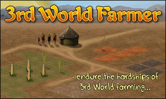
This simulation based game challenges players to try to live as long as possible and see if they can be successful against droughts, failing markets, and political problems.
|
Videos and Series
Anthony Bourdain: Parts UnknownA culinary exploration by renowned chef Anthony Bourdain. In search of some of the world's most unique foods and cultures, Bourdain takes a unique look at diversity.
BBC One: Planet Earth
BBC series highlighting the biodiversity in the earth's different ecosystems
|
Where the Hell is Matt?Youtube celebrity Matt Harding dances badly around the world. Great way to highlight some of the most remarkable human and natural landmarks
TED Talks: Global IssuesAcademic lectures dealing with a variety of topics dealing with Global Issues
|
Long Way Round
Actors Ewan McGregor and Charley Boorman take motorcycle journeys around the world, showcasing culture and landscape alike.(Warning: Language)
Geospatial Revolution
A public research outreach iniative put together by Penn State University. The Geospatial Revolution series highlights the uses of Geospatial technologies, like GIS, at local, national, and global scales.
|